Why Smart Site Mapping Is Changing Modern Construction Projects
Construction sites have never really been calm places. There is always noise, movement, last-minute adjustments, and someone trying to solve a problem before it slows the whole project down. That is probably why more builders and site managers have started looking for tools that make daily work feel a little less chaotic. One of the biggest changes in recent years has been the rise of drone construction surveying, not because it looks impressive, but because it genuinely helps people work with better information from the start.
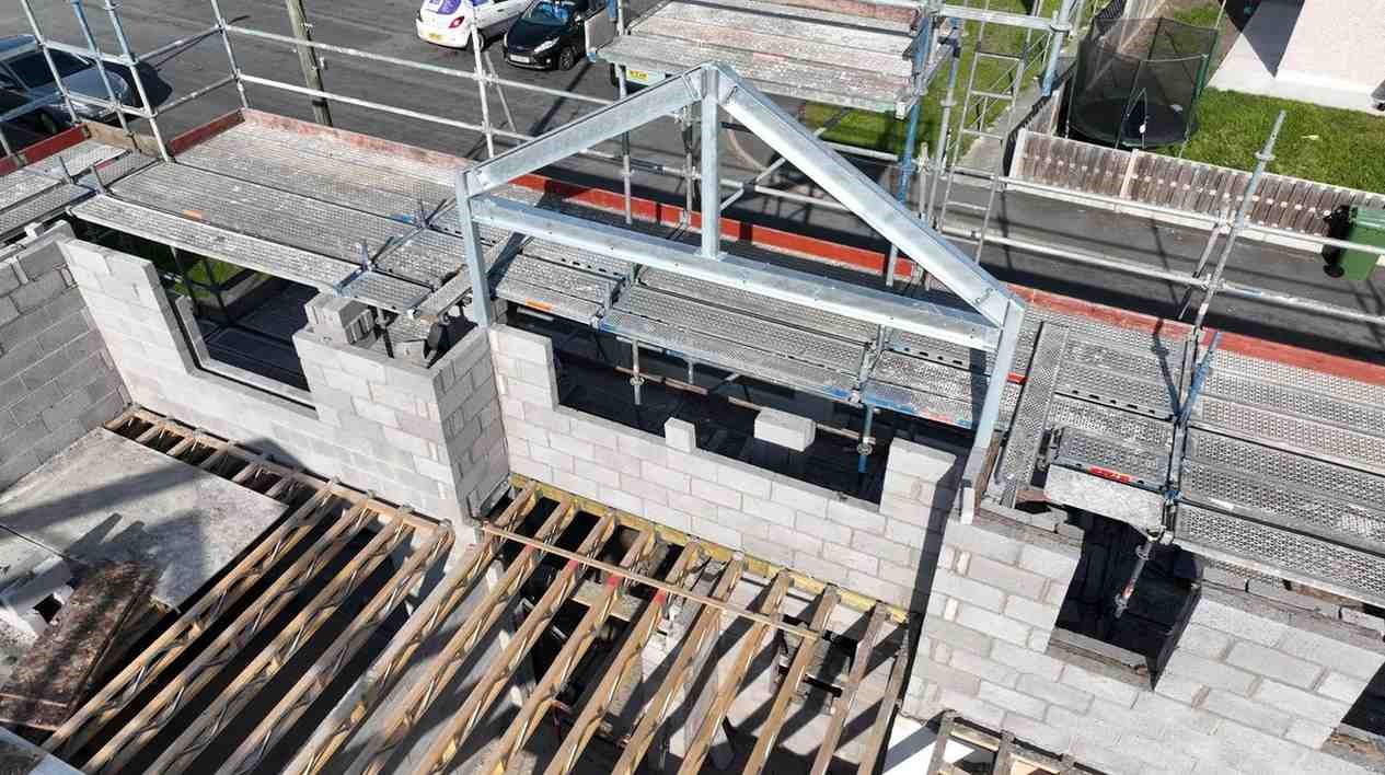
What makes drones useful is the simple fact that they show things from an angle most teams never normally get to see. A full aerial view can reveal uneven ground, blocked access points, drainage issues, or material placement mistakes that are easy to miss from the ground. That kind of visibility saves time, reduces confusion, and often prevents small issues from turning into expensive delays later on.
Better Site Decisions Often Begin With a Clearer View Above
One thing that slows construction projects down more than people admit is poor communication. Different teams can look at the same site and still come away with completely different ideas about what needs attention first. Aerial mapping helps remove some of that confusion because everyone works from the same visual reference instead of relying on rough sketches or rushed explanations during meetings.
Progress Tracking Feels More Accurate and Less Stressful
Keeping track of progress on a busy site is not always easy. Things move quickly, weather changes plans, and updates sometimes get lost between teams. Regular aerial scans make it easier to compare site conditions over time and spot delays before they become serious problems. Managers can quickly check whether groundwork, framing, or access routes are staying on schedule without constantly walking every corner of the site.
Visual records also help when discussing changes with clients or contractors because there is clear evidence showing what has already been completed. That usually creates fewer misunderstandings and far less unnecessary back and forth.
Safety Checks Become Easier in Difficult Areas
Construction work naturally comes with risks, especially when inspections involve unstable surfaces, rooftops, or elevated structures. Drones help reduce some of that pressure because teams can inspect hard-to-reach areas without immediately placing workers in dangerous positions. It is a practical shift that makes sense for both small and large projects where safety needs constant attention.
At the same time, many teams are finding creative ways to combine aerial mapping with professional drone videography to document long-term projects in a more organised and visual way. Instead of relying only on written reports, they can build a clearer timeline showing how a project develops from start to finish.
Technology Is Helping Construction Feel More Efficient
There is a tendency to think every new piece of technology is just another passing trend, but drones seem to be settling into construction work quite naturally. They are helping teams plan better, monitor progress more accurately, and avoid mistakes that would normally take days to notice. The biggest advantage is probably not speed or visuals alone, but the simple ability to make clearer decisions with less guesswork involved.
Conclusion
Construction projects will always have moving parts and unexpected problems, but better visibility makes those problems easier to manage. Drones are quietly becoming one of the most useful tools on modern sites because they improve communication, support safer inspections, and help teams stay organised from beginning to end. Sometimes the smartest changes are the ones that simply make everyday work run a little smoother.


Leave a Reply